
 Uncategorized
Fertilizer from human waste faces scrutiny but remains a profitable industry
Fertilizer from human waste faces scrutiny but remains a profitable industry
The cool morning spring breeze hit Saundra Traywick “like a punch to the face.”
Walking through her wooded 38-acre donkey farm in central Oklahoma, Traywick suddenly found it hard to breathe as the air smelled “toxic” and “like death.”
Less than a mile away, a truck was spreading a chunky dark fertilizer on a hay farm, a familiar ritual in this rural community just beyond Oklahoma City’s northeast suburbs.
But this fertilizer was putting off a smell that Traywick had never encountered. She soon discovered the fertilizer was made from processed sewage.
Converting sewage to fertilizer saves cities money on landfill costs, is a cheaper nutrient-rich fertilizer for farmers, and has become a billion-dollar industry for a handful of companies. However, biosolid fertilizer has been shown to contain chemicals that can harm the environment and human health.
“Essentially anything that goes down the drain ends up on these fields,” said Traywick, who, months after first learning about biosolid fertilizer, urged the nearby town of Luther to ban it, which city leaders did in 2020.

Scientific studies are increasingly warning about the PFAS chemicals found in biosolid fertilizers. PFAS — short for per- and polyfluoroalkyl substances, also called “forever chemicals” — can be found in many water- and heat-resistant products, personal hygiene materials, medication and industrial waste.
But while some states have recently restricted or banned biosolid fertilizer entirely after finding it contaminated farmland and groundwater, Oklahoma lawmakers and environmental officials attempted to take steps this year to protect cities and corporations from liability if new health problems are found.
The EPA estimates that as much as 3.5 million dry metric tons of treated sewage waste is spread as fertilizer across the country yearly — enough to cover the entire state of Missouri.
Oklahoma has one of the most extensive biosolid fertilizer programs in the nation, as more than 80% of the state’s wastewater sludge ends up on crop fields, according to Investigate Midwest’s analysis of state records.
Synagro, a Goldman Sachs-owned company that spreads most of the biosolid fertilizer in Oklahoma and across the country, has lobbied against new regulations over “forever chemicals” in its fertilizer, even as it faces lawsuits from farmers claiming its product has devalued their land and created numerous health problems. “Biosolids are a nutrient-rich end-product of the wastewater solids treatment process that have been treated to ensure safe use in agricultural land application,” the company said in a statement.
The issue has also taken center stage in an Oklahoma state House race, as a longtime lawmaker who uses biosolid fertilizer on his land risks losing to a challenger who wants to end the practice.
“I’d say it’s one of the main issues,” Traywick said about the upcoming state House election.
While scientists have discovered PFAS chemicals already exist in the blood of nearly every living person and animal on the planet, recent studies have raised concerns about increased PFAS exposure through its presence in biosolid fertilizers, which impacts the air, water and food.
- Air: UCLA researchers found that microplastics in biosolid fertilizer are highly suitable to wind, “thereby increasing … inhalation health risks,” such as lung tissue damage, according to a study published in January.
- Water: Groundwater near biosolid fertilizer-applied fields often have elevated rates of PFAS, sometimes at higher rates than what is deemed suitable for human consumption, according to a 2024 study published by the American Chemical Society.
- Food: In 2022, beef from a Michigan farm was contaminated with high levels of PFAS that officials said came from biosolid fertilizers.

“The scientific community has put a lot more focus (recently) on PFAS and how dangerous they can be even at low levels,” said Jared Hayes, a policy analyst with the Environmental Working Group who specializes in “forever chemicals.”
In response to growing health concerns, the Environmental Protection Agency recently announced it will require municipal water systems to remove nearly all PFAS substances. These regulations, some predict, could cost as much as $3 billion in new equipment nationwide.
However, the new rules don’t change the current standards of PFAS exposure in fertilizer.
“There are a lot of unknowns of what we are going to do with the biosolids,” Hayes said.
Biosolid fertilizer rankled a town and a state House election
Driving down a rolling two-lane road in central Oklahoma, Jenni White lifted her right hand off the steering wheel of her silver Honda CRV to point to another field that uses biosolid fertilizer.
“That field is one of the worst; I mean, I was hacking up a lung when it was spread, I could not catch my breath, it’s so strong,” said White, pointing through her bug-splattered windshield.

As she passed the next field, White recalled that the farmer had recently stopped using biosolid fertilizer when his neighbors complained. “I think he just thought it wasn’t worth the hassle,” White said.
White was mayor of Luther in 2020 when Traywick, the area donkey farmer, approached the town with concerns over biosolid fertilizers. White was already aware of its use but believed Traywick’s activism warranted discussion among Luther’s five elected trustees.
A ban in Luther wouldn’t impact many farmers, as the town is less than five square miles and most of the area farms are outside its boundaries. But the discussion drew a visit from two officials from Synagro.
One of the officials, identified as Layne Baroldi by the Luther Register, gave a presentation on the benefits of biosolid fertilizer.
Baroldi said California had some of the strictest environmental regulations in the country — you “can’t cough without getting cited,” so the fact that biosolid fertilizer is allowed there should be reassuring to folks in Oklahoma. “Putting it on the ground was (the) best practice,” Baroldi told the trustees.
But the presentation wasn’t enough, as the trustees voted to enact the ban.
(Investigate Midwest spoke to five Oklahoma farmers who use biosolid fertilizers but none would speak on the record due to local opposition. Most said their fertilizer costs would increase significantly if biosolid fertilizer were unavailable. “I got an extra hay cutting this year after using it,” one Oklahoma farmer said. )
While the Luther ban only impacted a few farmers, White, whose term as mayor ended in 2021, believes it was an important message from a community where agriculture remains a vital part of the local identity.
“We’ve been called a bunch of crazy environmental activists, but I don’t know how it’s crazy to make sure your food and water aren’t contaminated for your kids,” said White, a Republican who drinks from a Donald Trump-themed thermos while driving.
“A Democrat or a liberal is going to drink the same tainted water that a Republican or conservative is. Everybody is screwed, it’s not a selective screwing,” she added.
But biosolid fertilizer is rankling local Republican politics as it’s become a central issue in the race for House District 32, which is near Luther.
Incumbent State Rep. Kevin Wallace appeared to be a lock for reelection. He has represented the heavily conservative seat for five two-year terms and has risen up the ranks of Republican politics, including as chair of the high-profile House budget committee.

However, Wallace’s use of biosolid fertilizer on his land has drawn criticism from voters. During a June 4 candidate forum, Wallace was confronted by some constituents who asked why he wouldn’t come out against the fertilizer, what they called “humanure.”
“The biosolids sludge is regulated by the Department of Environmental Quality, I have used it twice … it has been legal to use in this state for eight years now,” Wallace said at the forum.

Wallace acknowledged he had received complaints from his neighbors, but “property rights is what I’m for … (and) I’m not breaking the law,” he told the audience.
Two weeks later, Wallace finished second in the Republican primary, advancing to an Aug. 27 runoff against challenger Jim Shaw, who opposes the use of biosolid fertilizer.
Wallace declined an interview request but in an emailed statement said biosolid fertilizer was “heavily” regulated at the state and federal levels.
“I have had the Department of Environmental Quality into the district in the past to answer questions at a forum and the state of Oklahoma has worked directly with top administrators at the EPA in Dallas on this issue to ensure environmental standards are met,” Wallace said in his statement. “The bottom line is, the only alternative to current disposal of biosolids is for more of it to be dumped in landfills, which will create more landfills in rural Oklahoma.”
More than 44,000 metric tons of biosolids were applied on Oklahoma fields in 2023, according to records from the Oklahoma Department of Environmental Quality, which issues permits to apply biosolid fertilizer. Around 40% of all biosolid fertilizer in the state was processed by Oklahoma City waste.
Oklahoma has limits for 10 pollutants in fertilizer, including mercury and arsenic. State laws also require fertilizer to have a solid consistency of greater than 50%, be tested for viruses and to raise the pH level, which is most often achieved through the use of lime.

But Shaw, the District 32 challenger who finished first in the June Republican primary, said if he were elected it would send a message that “the majority of people out here are saying no to this practice.”
“I would say the awareness of (biosolid fertilizer) has significantly increased in recent months, especially during the campaign,” Shaw said. “I’m all for property rights but my right to swing my fist stops where it hits your nose, … and once (the fertilizer) is applied it does reach beyond the four corners of your property.”
Federal regulations spurred a biosolid industry controlled by a few companies
When Congress passed the Clean Water Act in 1974, cities and towns faced stricter rules on how to process sewage. New biosolid materials needed to be disposed of and a handful of companies launched in an effort to fill the need.
Business picked up over the years as new rules were set, including a federal ban on dumping biosolid material in the ocean.
Established in 1986 in Texas, Synagro contracted with hundreds of cities to handle its biosolid waste, including land application as fertilizer. In 2000, the company purchased BioGro, another large biosolid firm, becoming the largest biosolid handler in the nation.
Synagro is a privately held company, so its valuation isn’t publicly available. However, in 2013 a European investment firm purchased the company for $480 million.
Since then, Synagro has acquired several other companies, entered the Canadian market and nearly doubled the number of municipal and industrial wastewater facilities it contracts with.
In 2020, Syangro was sold for an undisclosed price to West Street Infrastructure Partners III, an investment fund managed by Goldman Sachs.
Today, the company operates 24 facilities in the U.S. and Canada and handles 6.5 million tons of biosolid material annually, according to a 2023 company report.
“Biosolids provide multiple benefits to overall soil quality and health, including improved moisture absorption ability, recycling of micro and macro nutrients, carbon avoidance, reduced nutrient leaching, and lower use of industrially produced chemical fertilizers,” a company spokesperson wrote in an emailed statement to Investigate Midwest. “U.S. EPA and state environmental agencies have approved and regulated biosolids for decades and multiple risk assessments and scientific studies have found that biosolids recycling presents little to no risk to human health and the environment.”

Synagro handles much of the biosolid material produced by Oklahoma City’s wastewater system, although it doesn’t contract directly with the city.
Oklahoma City contracts with Inframark to manage its wastewater system. Inframark then sells the biosolid material to Synagro.
“The City of Oklahoma City (does not) have a direct contract with Synagro,” said Jasmine Morris, a spokesperson for the city, when asked why Investigate Midwest was unable to get a Synagro contract through an open records request. “Under contract with (Oklahoma City), Inframark is responsible for the disposal of biosolids. Under said contract, what Inframark self-performs, or who they subcontract to, is at their discretion. Currently, they are using Synagro South LLC for this activity, but the terms of their contract with Synagro are not disclosed to (the Oklahoma City Water Utilities Trust).”
Amid the increased focus on PFAS chemicals in waste and fertilizer, Synagro has also lobbied to ensure cities and companies are not held liable.
In 2022, the company created a nonprofit business association called the Coalition of Recyclers of Residual Organics by Practitioners of Sustainability (CRROPS). Synagro’s CEO, Bob Preston, serves as chairman of the organization, which has spent $220,000 on federal lobbying since its founding, according to lobbying disclosure forms.
Last year, as the EPA considered new rules on PFAS levels in drinking water, the coalition urged lawmakers to shield companies and cities from legal liability.
“We write to urge that any legislation … include a specific provision to ensure that the organizations we represent are explicitly recognized as ‘passive receivers’ of PFAS and afford these essential public services a narrow exemption from liability under the Comprehensive Environmental Response, Compensation, and Liability Act (CERCLA),” CRROPS wrote in an Aug. 24, 2023 letter.

But as Synagro attempts to someday prevent lawsuits, legal challenges have already arrived.
Earlier this year, five Texas farmers sued Synagro, claiming their properties were “poisoned by toxic chemicals” in the biosolid fertilizer the company spread on nearby farms. Some of the plaintiffs also claim they began suffering from respiratory problems and skin irritation when the biosolid fertilizer was spread.
Many of the plaintiffs also claim their groundwater has elevated levels of PFAS, with one farmer stating that a serving of one fish from his pond would exceed the EPA’s recommended PFAS exposure by 30,000 times.
For the past five years, Synagro has contracted with the city of Fort Worth to manage its biosolids programs and has spread the processed waste in 12 north Texas counties. The lawsuit claims Synagro should have issued stronger warnings about its fertilizer product.
“Synagro knew, or reasonably should have known, of the foreseeable risks and defects of its biosolids fertilizer,” the lawsuit states, which was filed in Maryland, where Synagro is based. “Synagro nonetheless failed to provide adequate warnings of the known and foreseeable risk or hazard related to the way Synagro (Granulite) was designed, including pollution of properties and water supplies with PFAS.”
In a statement to Investigate Midwest, Synagro denied the allegations, calling them “unproven and novel.”
“As a matter of fact, without any response from Synagro, the plaintiffs have already amended the complaint to drastically reduce the concentrations of PFAS alleged in the complaint when it was originally filed,” the company said in an emailed statement. “The biosolids applied by a farmer working with Synagro met all U.S. EPA and Texas Commission on Environmental Quality (TCEQ) requirements. U.S. EPA continues to support land application of biosolids as a valuable practice that recycles nutrients to farmland and has not suggested that any changes in biosolids management is required.”
Some push for nationwide regulations
As Synagro lobbies for federal liability protections, lawmakers in Oklahoma recently considered a similar proposal that would protect cities and companies from lawsuits if the biosolids they produce and convert into fertilizer were later found to be harmful.
Oklahoma House Bill 2305 stated that a waste management or disposal company, along with a public wastewater treatment facility, “shall not be liable … for costs arising from a release to the environment of a PFAS substance” as long as state laws are followed.
The bill received overwhelming bipartisan support in both the House and Senate but failed to receive final approval before the legislative session ended in May.

During an April 4 Senate committee hearing, Sen. Dave Rader, a Tulsa Republican, presented the bill and said he wanted to ensure cities were protected from liability since they were not responsible for producing the chemicals found in biosolid fertilizers.
But one lawmaker asked if the bill would still protect polluters.
“Does this create an alibi for the person who pollutes a water source and says, ‘I followed the state procedure, so it’s not my fault?’ ” asked Sen. Dusty Deevers, an Elgin Republican.
“I suppose it could,” Rader answered.
Scott Thompson, then the director of the Oklahoma Department of Environmental Quality, was also in the room supporting the bill.
“(Cities and towns) are receiving this PFAS in the waste stream … what we are concerned about is the future liability under the federal law as they get passed,” Thompson told lawmakers. “(The EPA) is going to very tiny numbers that we have to measure and essentially creating potential liability for everyone that has to receive this and manage it.”
Asked about Thompson’s comments, Oklahoma Department of Environmental Quality officials reiterated their support.
“DEQ would support some version of federal legislation that provides protection for certain passive receivers who provide critical, public health services,” said Erin Hatfield, the agency’s director of communications and education. “As for increased PFAS standards, DEQ would like to see additional research done to further determine health impacts related to PFAS and standards based on scientific findings.”
Other states have said the health impacts are already apparent and biosolid fertilizer should be banned or severely restricted.
In 2022, the Maine legislature banned the use of biosolid fertilizer and allocated $60 million to help contaminated farms, including many dairy farms that were forced to shut down.
In Michigan, where cattle farms have been forced to shut down due to tainted beef, biosolid PFAS standards are stricter than in most states. The state also has an aggressive investigation program to try to identify the specific source of PFAS contaminants.
However, some environmental watch groups have scoffed at a state-by-state approach, calling for nationwide regulations instead.
Earlier this year, the Maryland-based environmental nonprofit Public Employees for Environmental Responsibility, or PEER, sued the EPA over the lack of biosolid fertilizer standards.
“EPA has deemed it acceptable for biosolids containing PFAS and other known toxic chemicals to be applied directly to soil as fertilizer, where these man-made contaminants then build up in the environment, exacerbating the PFAS contamination crisis,” Tim Whitehouse, PEER executive director, wrote in a Feb. 22, 2024 letter to the EPA. “This is not protective of human health or the environment.”
The EPA declined to comment on pending litigation.
While the EPA has made progress on congressionally-mandated PFAS rules related to drinking water, it has yet to complete a risk assessment of PFAS in biosolid, according to tracking by the Environmental Working Group nonprofit.
“We are really hoping to see them finish that up by the end of the year and to really get a good picture of just how much of our overall exposures to PFAS is the result of PFAS in biosolid potentially contaminating our food supply and our environment,” said Hayes, the policy analyst with EWG. “In the meantime, states have been leading the charge and taking action.”
This article first appeared on Investigate Midwest and is republished here under a Creative Commons Attribution-NoDerivatives 4.0 International License.![]()
 Uncategorized
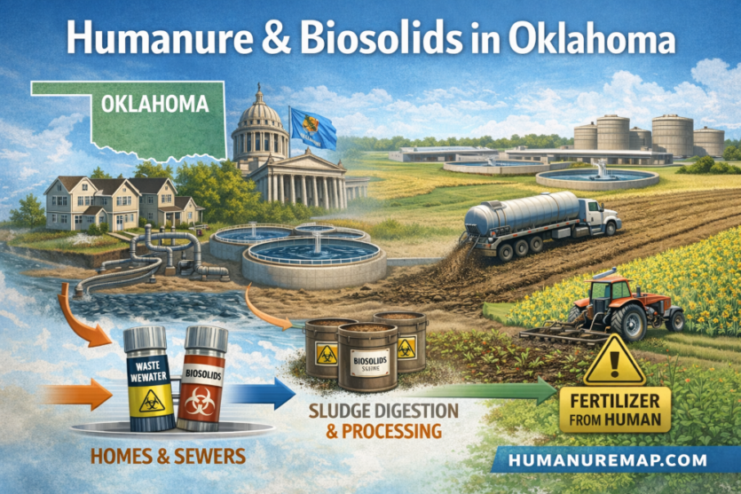
HumanureMap.com Launches
HumanureMap.com Launches Nationwide Initiative to Crowdsource Tracking of Humanure and Biosolids Land Application
HumanureMap.com today announced the launch of a new public mapping initiative designed to increase transparency around the land application of humanure and biosolids across the United States. The platform invites farmers, neighbors, researchers, and concerned citizens to help document when and where these materials are being applied to agricultural land.
Humanure and biosolids—treated human waste products commonly used as soil amendments—are legally applied to farmland in many states. While federal and state agencies regulate aspects of treatment and application, there is currently no single, easy-to-access, nationwide public map that allows communities to see where spreading activity is occurring in real time.
HumanureMap.com aims to change that.
“Our goal is transparency,” said the site’s founder. “We are not here to attack farmers or operators. We are here to provide a centralized, publicly accessible tool that allows people to document and view land application activity in their area. Communities deserve clarity about what is happening on nearby farmland.”
The HumanureMap platform allows users to submit reports by dropping a pin or marking an approximate area on an interactive map. Submissions may include the date of application, material type (humanure, composted humanure, biosolids, septic residuals, or unknown), method of application, and a short description. All submissions are moderated before appearing publicly to ensure that the information remains factual and focused on land application events—not personal accusations.
The initiative welcomes contributions from a wide range of participants:
- Farmers documenting their own soil amendment practices
- Neighbors reporting observed spreading activity
- Journalists and researchers citing public records
- Community members seeking better awareness
HumanureMap emphasizes that crowd-submitted data may not be complete or verified by government agencies. The site clearly identifies the source of each report (self-report, public record, observation, etc.) and encourages users to provide accurate, good-faith information.
Across the United States, biosolids and treated waste products are used as nutrient sources for crops and pasture. Supporters cite soil health benefits and nutrient recycling. Critics raise concerns regarding odor, runoff, contaminants, and long-term environmental impact. HumanureMap does not take a policy position; instead, it seeks to create a transparent, open data environment where facts can be documented and viewed.
“Regardless of where someone stands on the issue, sunlight is always helpful,” the founder added. “When information is accessible, communities can have informed conversations.”
The platform is currently live and accepting submissions for all 50 states. Users can visit the website, explore existing reports, and contribute their own observations in just a few minutes.
HumanureMap encourages participation from individuals across rural and urban communities alike. By building a shared, nationwide map of land application activity, the project hopes to foster awareness, accountability, and informed dialogue.
For more information or to submit a report, visit: